


Driving Guide to the North Klondike Highway
Driving the North Klondike Highway you'll travel through mountain ranges that are covered with snow all year long, sparkling rivers that meander through the countryside and wildlife that doesn't care if you are there. Take Five Finger Rapids just outside Carmacks for example, here you will witness how nature and humans interact in perfect harmony. The river was used by the pioneers of the gold rush to transfer their claims back to civilization, but nowadays many canoers and kayakers love the challenge of the rapids.
There aren’t many places in North America where you can feel like you are the only person alive, whilst experiencing Canadian history first hand, if you leave the highway for a moment on foot, you are in a wilderness, just you and your thoughts, with the surrounding tundra untouched for thousands of years.
The North Klondike Highway winds through or close to settlements such as Braeburn, Carmarks, Mayo and Stewart Crossing that are older than Canada itself, where in places you can appreciate hunting and fishing methods that were popular hundreds of years ago.
Travelling to Faro on the Robert Campbell Highway you will view spectacular valley’s rivers and lakes as you travel down the road. Then there is Keno City, a relic of the Gold Rush that has a population of 20 and a magnet for people wishing to move off the grid for a while. A habitant once said of Keno City that it was like time went on holiday in 1978 and never came back.
Finally, when you arrive in Dawson City, you experience a place that has one foot in the past, with taverns and gambling halls that once owed more to the entertainment of prospectors, however modern-day explorers will love the laid-back attitude and the throwback to a bygone era, whilst enjoying the modern delights as well.
Even when you are done with Dawson, your adventure could only just be beginning, as The Top of the World Highway starts once you have crossed the river, leading into Norther Alaska and beyond.
Eclipse Nordic Hot Springs
Formerly known as the Takhini Hot Springs. Located at the end of the Takhini Hot Springs road and about 28km/18miles from Whitehorse and 10kms/6 miles off the North Klondike Highway.
Km 195.5 Takhini River Bridge
Km 197.5 The Gunnar Nilsson and Mickey Lammers Research Forest is marvelous place to wander or bike along the trails, there is a play park, and bike track for the younger members of the family.
Takhini Hot Springs is 28km/18miles from Whitehorse and 10kms/6 miles off the North Klondike Highway. You'll also find another major attraction on the Hot Springs road, the Yukon Wildlife Preserve which is spread over 350 acres and is home to more than 12 Yukon species.
Km 224.6 Lake Laberge outside of Whitehorse 16 sites 12 pull through. There is a boat launch and is good for fishing Pike, Grayling and Lake Trout on the 48.2 km/30-mile lake. Be aware that when the wind picks up the Lake can become rough very quickly.
Km 247.7 Fox Lake Campground 43 sites 9 of them Pull through Boat Launch, fire pits $8 fee The Southern Tutchone name is Kwatan aya. Good fishing for Trout, Burbot and Grayling. A favourite of Whitehorse residents
Km 272 Fox Lake Burn Rest Area
Km 280.8 Braeburn Lodge 109.8km/68 miles Famous for the huge Cinnamon buns it sells, is a necessary stop for all travellers. It was once a roadhouse on the overland trail and is used as a checkpoint on the Yukon Quest sled dog race in February
Km 298 Conglomerate Mountain Rest Area Outhouses, interpretive signs, and garbage bins. You can view the mountain from here, it was formed 185 million years ago by volcanic mud flows
Km 308 Twin Lakes 31 sites 9 pull through Boat Launch Excellent fishing for Pike, Grayling and Lake Trout as well as to Canoe/Kayak. The Southern Tutchone name for the lake is Deghal Shaw
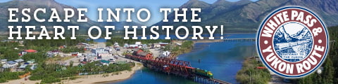
Km 322.4 Montague Roadhouse This roadhouse is the third reincarnation of its name but is rich in history for this part of the Yukon. It served as a resting point for many weary travellers and was part of a chain of roadhouses that were spaced 30-40km apart and formed the overland trail from Whitehorse to Dawson. The White Pass and Yukon Railway had the contract for the mail and took over the roadhouses which boasted corrals, barns, and stables. A traveller would have to pay $125 for the 5–7-day journey on the stage.
Km 356.8 Carmacks Named after George Carmarks who found coal nearby and was a pioneer of the Klondike Gold Rush The settlement of Carmarks was at first a steamboat stop then grew when the Overland trail went through the village.
Carmacks is the start of many fantastic walks or hikes ranging from half an hour up to 2 hours. You can take in the picturesque vista that the river and countryside give. If it is a hot day and you need a break from driving perhaps the Coal Lake Hike is for you. It’s a 4km walk in total but you have the chance to swim/picnic at the lake. The settlement of Carmarks grew when the Overland trail went through the village.
Km 358.4 Coal Mine Campground Private campground featuring tent sites right along the Yukon River, RV sites and cabins also located right along the riverside. It also offers take-out restaurant with delicious burgers, homemade desserts, fresh coffee and drinks. The campground also offers a dump-station and shower.
Km 359.1 Campbell Highway Junction, which connects Watson Lake and Carmacks and goes through the villages of Faro and Ross River.
Just after the junction is the Historic Tantalus Butte Coal Mine although now closed it is said that you can still see smoke rise from the seam.
Km 380 Five Finger Rapids 23kms outside of Carmacks is the wonderful Five Finger Rapids, mentioned in Jack London’s novel Call of the Wild, this place is steeped in Yukon History and is also a great photo opportunity. Once you arrive there are several options that are open to you depending on the time of year and your luck. You can feed the Grey Jays right out of your palm as they are very friendly creatures. The long stairway lead down to a 2 km walk from the rest stop down towards the river ending on the cliffs overlooking the rapids, be aware that it is an energetic hike back up to the road.
Km 382 Tatchun Creek Campground 12 sites 4 pull through, no fishing here from the 1st of August to the 31st of September to protect the Chinook Salmon run.
Km 431 Minto Landing offers access to the Klondike highway, there is the Minto Resort, with many tenting spots.
465Km Pelly Crossing Small First Nations community, it has a gas station, dump station, grocery store and an RCMP detachment. The Selkirk Heritage Centre is near the grocery store and a worthwhile stop to learn more about the Selkirk First Nation and their traditional ways .
519.7 Km Crooked Creek Rest Area, with Grayling and Pike fishing
535 Km Stewart Crossing, as you descend the hill to the Crossing there is a sign persuading you to visit the old mining town of Mayo, which it claims has the hottest and coldest temperature annually in the Yukon. At the south end of the bridge there is an information centre and rest area.
555.5 Km Stewart River
Km 559 Moose Creek Campground 36 sites and 4 pull throughs. Picnic shelter, hiking trails, with good Greyling fishing. Make noise and bring bear spray when hiking as wildlife uses this area.
KM 625.5 Gravel Lake
KM 655.1 Tintina Trench Rest Area Interpretive signs show how glaciation has changed the flow of major rivers in the trench. Some very nice views as well.
Km 674.7 Dempster Highway Junction
Km 671.5 Klondike River
Km 696.7 Klondike River Campground 35 sites and 2 pull throughs. Has an interesting 1.7km interpretive trail and boardwalk through an old growth forest.
KM 697.5 Dawson City Airport
Km 688.6 Dawson City entrance
Km 713 Crocus Bluff Trail
Km 712.4 Bridge over the Klondike River. The bridge represents entering Dawson City.
Km 714 Dawson City
Dump Stations
Takini Hotsprings
Carmacks Hotel and RV Park km 355 Cost
Sunrise Service Centre km 355
Coal Mine Campground km 357
Campgrounds a short distance from the North Klondike Highway
Yukon River Campground Top of the World highway 102 sites and 20 pull throughs, just across the river using the free George Black ferry. It's the largest campground in the Yukon, very popular during the Dawson Music Festival
Frenchman Lake Campground Robert Campbell Highway 10 sites 2 pull throughs Small intimate campground good for swimming and boating
Nunatak Campground Robert Campbell Highway 15 sites 4 pull throughs A mix of sites in the forest and by the lake.
9Km off North Klondike Highway Tatchen Lake Campground 20 sites no pull through. Still used today by the Little Salmon/Carmarks First Nation as a camp to fish for Whitefish, trap Beaver and hunt for Caribou and Moose.
524Km Ethel Lake 24km off the North Klondike Highway 10 sites no pull throughs, it's a long windy gravel road into the campground. Very quiet and scenic. The road isn't great but if you travel slowly you can make it with a large RV as well, but easier to travel with a truck camper. There is a boat launch and fishing there.
Drury Lake Robert Campbell Highway 10 sites and 5 pull throughs, has a wonderful view of Little Salmon Lake
Little Salmon Lake Robert Campbell Highway 22 sites 7 pull throughs. Be mindful about fishing restrictions to protect the Trout population. Be careful if it gets windy.
Other Fishing
Wrong Lake is 28 kms south of Stewart Crossing and 41kms north of Pelly Crossing and is stocked with rainbow Trout for any interested anglers.
Yukon River Quest
The world’s longest annual canoe and kayak race 714km/444miles. Normally late June-early July. The race starts in downtown Whitehorse and follows the river all the way through to Dawson. There are many places along the North Klondike Highway that you can watch the paddlers go through. It is truly a phenomenal experience to see these ultra-athletes pit themselves against mother nature.
Camping Permits
Yukon camping permits go on sale on the 1st of April, which you can use at the 42 road-accessible campgrounds in the territory. Or you can buy a permit at the entrance of the campsite. Camping season opens on the 1st May